What is Real-time kinematic?
Real-time kinematic, also known as RTK, is a surveying technology which measures the relative positions while using two different Global Navigation Satellite System (GNSS) antennas in real-time with better accuracy. The errors found in GNSS results are decided and fixed using RTK technology. The new generation of intelligent RTK systems provide reception of all available satellite signals. Because of this, slope measurement can be taken without centering and calibration increases productivity by 20%. With this high tech technology, it ensures continuation of a RTK survey incase of temporary interruption of correction signal reception.
Components and Working of Real-Time Kinematic (RTK) Survey
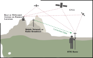
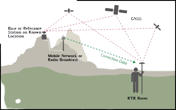
An RTK setup consists of two receivers. One of them, called the base station or GNNS receiver, is stationary, while the second receiver called rover moves freely.
The base station is a static point whose coordinates are fixed and determined by other precision methods in surveying. It uses GNSS to compute errors in this point by comparing it to its precise location. The error determined is transmitted in real-time to the rover. The objective of the antenna at the base station is to remain at one point and send the corrections to the moving receiver.
Rover uses these corrections to improve its computed position from the GNSS and achieve centimeter-level precision. More than one rover is used and can be connected to one base if their input settings match with the output from the base.
Traditional GNSS receivers measure the time taken for a signal to travel from a satellite to the receiver. These receivers determine the position with 2-4 meter accuracy. But the incorporation of RTK gives the relative position in centimeter accuracy.
RTK is mainly used for construction applications that require higher frequency like cadastral survey, drone navigation, and other construction activities.

Benefits of RTK
- RTK technology provides centimeter-level accuracy and eliminates human errors caused in traditional surveying.
- RTK systems rely on satellite, radio positioning and communication, thereby helping conduct surveying faster than traditional methods.
- RTK survey helps to develop construction layouts quickly.
RTK is mainly used for construction applications that require higher frequency like cadastral survey, drone navigation, and other construction activities. This technology is unavailable in marine areas, lands with obstructions such as trees, mountains, etc. , or projects that could disrupt communication. The RTK system requires a pre-surveyed base station with known coordinates beforehand.
In case you find the article useful and would like to support me, you can buy me a coffee ☕


