by samson | Sep 17, 2025
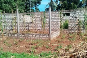
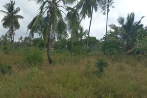
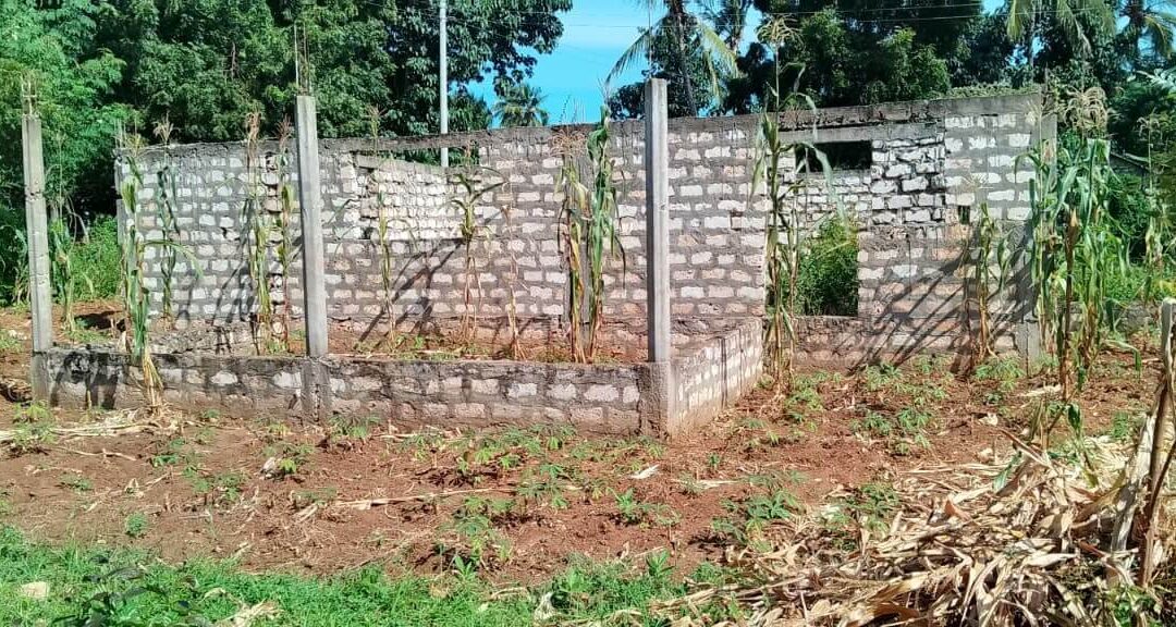
Discover a rare opportunity to own a spacious 10,000 sq ft plot in the serene and rapidly developing area of Kijiwetanga, Kilifi County. This property features an incomplete residential structure, offering the perfect blank canvas for those looking to design their dream home or investment property.
📍 Location Highlights
- Prime Area: Nestled in the peaceful neighborhood of Kijiwetanga, known for its tranquil environment and friendly community.
- Accessibility: Easily accessible via well-maintained roads, with convenient proximity to Malindi and Kilifi Towns, schools, markets, and healthcare facilities.
- Growth Potential: Kilifi County is experiencing rapid development, making this an ideal investment for future appreciation.
🏡 Property Features
- Size: 10,000 sq ft (approximately 0.23 acres), providing ample space for expansion, gardening, or outdoor activities.
- Existing Structure: An incomplete residential building awaits your personal touch—ideal for customization as a family home, rental unit, or vacation getaway.
- Versatile Use: Perfect for residential development, Airbnb, or long-term rental income.
🛠️ Utilities & Accessibility
- Road Access: Connected via a well-maintained murram road, ensuring easy entry and exit.
- Water & Electricity: Potential for connection to local utilities (subject to county regulations). Borehole drilling is also an option.
- Scenic Surroundings: Enjoy the lush greenery and calm atmosphere typical of Kilifi’s coastal landscape.
💡 Why Invest Here?
- Affordable Opportunity: The incomplete structure reduces initial costs, allowing you to build according to your budget and vision.
- High Demand: Kilifi’s growing popularity as a residential and tourist hub ensures strong rental and resale potential.
- Customization Freedom: Design the house of your dreams or a profitable rental property from the ground up.
- Title Deed Available: Secure ownership with no legal hurdles.
- Quick Purchase Process: Smooth transaction facilitated by trusted agents.
- Growth Potential: Ideal for both immediate use and long-term investment.
🎯 Perfect For:
- Homeowners seeking a peaceful retreat close to urban amenities.
- Investors looking to capitalize on Kilifi’s real estate growth.
- Developers interested in creating rental units or holiday homes.
📞 Contact Us Today!
Don’t miss out on this versatile property in one of Kilifi’s most promising locations!
Price: Negotiable | Terms: Flexible
Reach out to schedule a site visit or request more details!
✨ Key Selling Points:
Your dream property in Kilifi awaits—act now! 🏡🌴

by samson | Mar 29, 2025 | land survey
Steps to registering community land
Step 1: Community Registration
- Hold public meetings to pass a resolution.
- Submit Form CLA 3 (Application for Registration) signed by 15+ members.
Step 2: Public Meeting Notice
- The Registrar publishes notices in newspapers, radio, and local offices.
Step 3: Elect the CLMC
- Members (7–15) are elected via secret ballot. Submit Form CLA 2 for committee changes.
Step 4: Land Registration
- CLMC submits Form CLA 1 (Claim Application) with maps and governance documents.
- Receive Form CLA 4 (Certificate of Registration) upon approval.
Download Form CLA 1, Form CLA 2, Form CLA 3, Form CLA 4 and Form CLA 8.
Free Download: GEOROLE’S FREE CHECKLIST FOR COMMUNITY LAND REGISTRATION IN KENYA
Get our step-by-step guide to avoid missed deadlines and bureaucratic traps
by samson | Mar 20, 2025
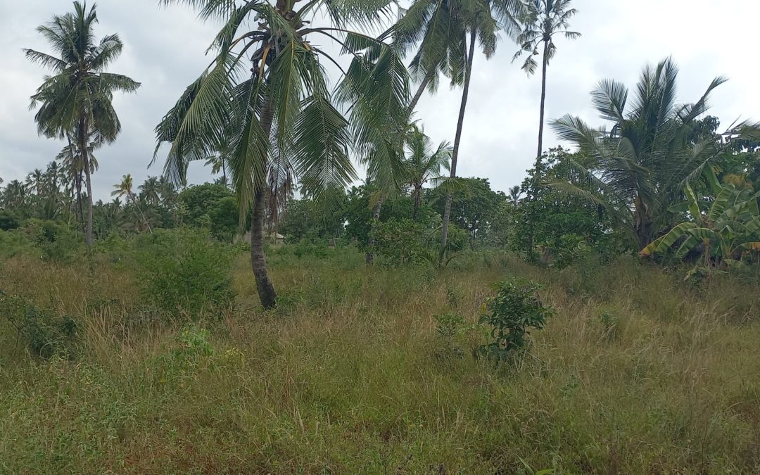
Nestled in the peaceful suburb of Chumani, Kilifi, this gently sloping 1-acre plot offers the perfect blend of agricultural potential and natural beauty. Mature coconut trees dot the landscape, providing shade and immediate income opportunities from coconut harvesting. With electricity, water, and a well-maintained murram road already in place, this land is move-in ready for farming, a homestead, or a quiet getaway.
Key Features:
- 1 acre of gentle terrain – Easy to cultivate or develop.
- Mature coconut trees – Generate income or enjoy fresh harvests.
- Prime suburban location – Peaceful yet close to Kilifi’s amenities.
- Utilities available – Electricity and water connected.
- Accessible murram road – Hassle-free entry for vehicles and equipment.
- Agricultural zoning – Ideal for crops, poultry, or agroforestry.
Why Buy This Land?
- Turnkey farming opportunity – Start cultivating immediately with existing coconut trees.
- Scenic and tranquil – Perfect for a rural homestead or eco-friendly retreat.
- Growing area – Chumani’s suburban charm offers potential for future value appreciation.
- Ready to use – No delays with utilities or road access—start your project today!
Imagine waking up to the rustle of coconut palms and the gentle coastal breeze! Whether you’re a farmer, investor, or nature lover, this land is a rare gem in Kilifi County.
Act fast – contact us today to arrange a visit or inquire further!
by samson | Mar 20, 2025
Title Deed Available | Flat Terrain | Coral Rocks Quarry | Coastal Proximity
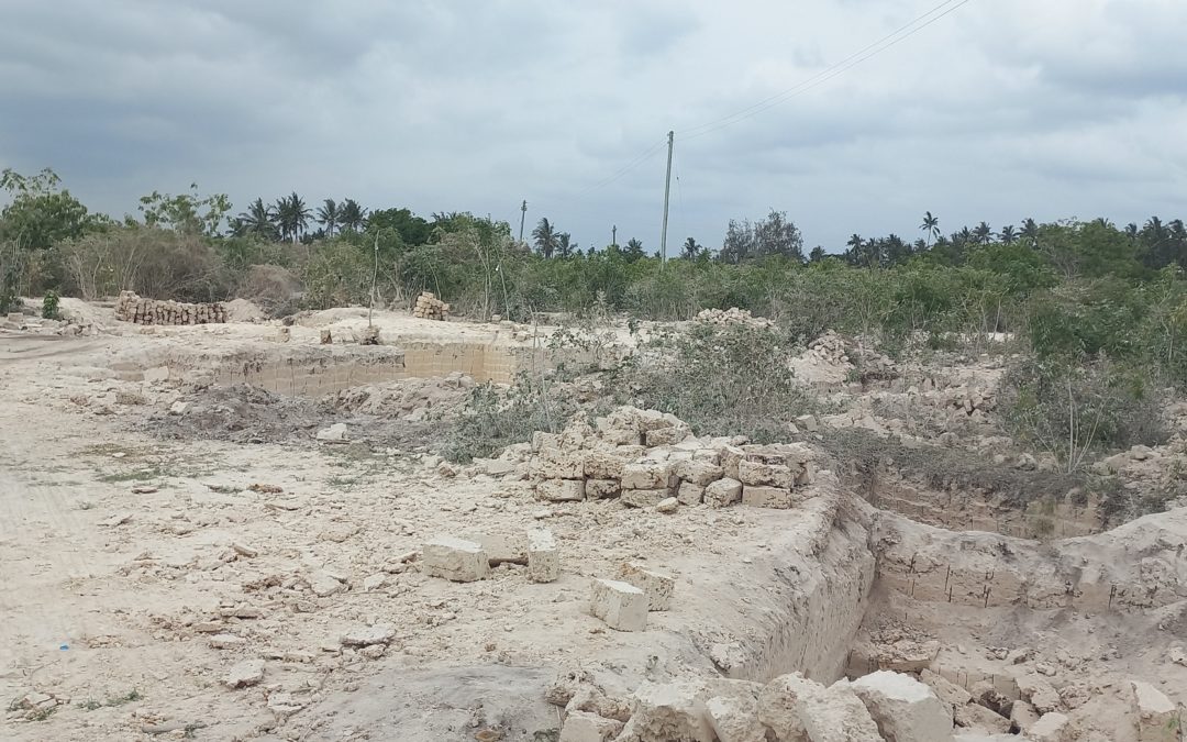
Discover a versatile investment opportunity in the serene suburban area of Chumani! This 8-acre plot combines agricultural potential, quarry resources, and coastal convenience, making it ideal for farming, eco-tourism, or future development.
Key Features:
✅ Flat Terrain with Coral Rocks: Ready for cultivation or quarry operations (coral rocks are in demand for construction).
✅ Agricultural Zoning: Perfect for crops, livestock, orchards, or agro-processing ventures.
✅ Utilities Available: Reliable water supply, electricity, and a well-maintained murram road for easy access.
✅ Strategic Location:
- 4km from Mombasa-Malindi Highway: Excellent connectivity to major cities.
- 1.5km from the Indian Ocean: Ideal for coastal breeze farming or future eco-friendly projects.
✅ Title Deed Guaranteed: Secure ownership with no legal hurdles.
Why Buy This Land?
- Dual-Use Potential: Farm and leverage coral rock resources for additional income.
- Proximity to Infrastructure: Close to highways, utilities, and coastal amenities.
- Scalable Investment: Expand operations or hold for future value appreciation in this growing area.
Perfect For:
- Farmers or agribusiness investors.
- Quarry operators or construction material suppliers.
- Eco-tourism or coastal retreat developers.
📞 Contact Today to Schedule a Site Visit!
Don’t miss this rare blend of agricultural productivity and coastal convenience!
by samson | Nov 27, 2024
Versatile Agricultural Plot | Title Available | Ideal for Multi-Purpose Development
This expansive 12.47-acre property in the serene Roka area of Kilifi County offers unparalleled potential for agricultural, residential, or commercial ventures. Situated just off the Mombasa–Malindi Highway and accessed via a well-maintained murram road, this land combines rural tranquility with strategic accessibility. With water and electricity available in the neighborhood, it’s primed for immediate development or long-term investment.
Key Features:
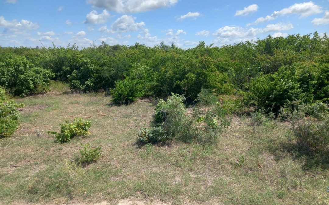
- 12.47 acres of cleared, developable land – Ample space for farming, eco-tourism, or large-scale projects.
- Title deed available – Secure ownership with no legal hurdles.
- Prime location – Minutes from the Mombasa–Malindi Highway for easy connectivity.
- Utilities nearby – Water and electricity accessible for future connections.
- Agricultural zoning – Ideal for crops, livestock, or agroforestry, with potential for rezoning.
- Peaceful surroundings – Escape the city bustle while staying connected to key coastal hubs.
Why Invest Here?
- Strategic growth area – Kilifi County is rapidly developing, offering high ROI potential.
- Multi-use flexibility – Perfect for farming, holiday homes, resorts, or a mixed-use estate.
- Road access – Murram road ensures hassle-free transport of goods and equipment.
- Scalable opportunities – Large acreage allows phased development or subdivision.
Seize this rare chance to own a sizable, titled parcel in one of Kilifi’s most promising areas! Whether you envision a thriving farm, a serene retreat, or a forward-thinking commercial project, this land is your canvas.
Contact us today to schedule a site visit or request additional details!


