by samson | Oct 7, 2022 | attachment
Field of attachment
Valuation
Requirements:
• Be a continuing student in a recognized institution studying either Certificate, Diploma, Higher Diploma or Degree in any of the following:
- Land Economics.
- Real Estates
• A computer laptop
Why Attachment at Georole Ltd?
- Engaged in field activities to gain experience in the field of Valuation. i.e., participating in valuation inspection and preparing valuation reports.
- Interact with government agencies related to Valuation.
Terms of Agreement
A. The Industrial Attachee Shall:
- Obey and observe all industrial/site safety rules and regulations;
- Serve the employer diligently and obey all lawful instructions of the employer;
- Not divulge any of the employer’s classified information;
- Not absent himself/herself during normal working hours without the permission of the employer;
- Not engage in any other form of employment during working hours;
- Attend or take such correspondence course as the employer may require;
- Avail himself/herself for continuous assessment by authorized persons to determine his/her achievements;
- Complete all assignments given by the trainer on time;
- Maintain the insurance cover for the period of attachment;
- Cooperate with fellow employees at work;
- Pay attachment fee of Kshs. 10,000.
B. The Employer (Georole LTD) Shall:
- Give the attachee proper induction and orientation of the organization;
- Place the attachee under a qualified and competent trainer;
- Provide necessary tools/equipment and materials during the period of attachment;
- Provide the best possible and diversified experience to the attachee;
- Assess the attachee using the provided assessment criteria and guidelines;
- Allow adequate access by the supervisor to assess the attachee;
- Furnish the institution (college/university) with reports on the progress and conduct of the attachee on the prescribed Form(s) and format.
NOTE:

by samson | Oct 6, 2022 | physical and land use planning
Have you ever come across with terms like change of use, extension of use, extension of lease or renewal of lease? This article summarizes the definitions and differences of these terms according to physical and land use planning act, 2019 amendment. Additionally, it provides a recommendation of when to apply for renewal of lease.
In this article we are going to cover briefly on:
Change of use
This means any alteration in the use, purpose or level of activity within any land or building that involves a material change that results in a use that is completely different from the previous use and which will require development permission or any development that is out of character as under the set Regulations, a zoning plan or an approved development plan, or under the lease conditions; The Change of Use is required when—
- the proposed project includes a significant change of the registered use of the land and constituting of a change of more than twenty per cent of the registered use of the land based on the plot coverage and plinth area; and
- the existing registered use of land is not in accordance to the approved plan or the zoning regulations.
Extension of use
This means additional use other than that registered on the land while maintaining the dominance of the existing registered user or the land. The extended user should be compatible with the existing user including the character of the neighbourhood; Extension of Use is required when the proposed development includes a change of registered land use not exceeding twenty per cent in instances where a developer intends to comply with any revised physical and land-use plans and land-use zoning regulations.
Extension of lease
This is a process by which the lessee, before expiry of the lease, seeks an additional unexpired term to that lease. A lease extension should state that the original agreement being extended, name both parties involved in the contract, and state when the lease begins and ends. The parties are supposed to know how a lease extension works and how it compares to other options at the time it ends, so that they are able to decide whether the lease extension is right for them. I would recommend this article for more information.
Renewal of lease
Lease renewal is a new lease agreement. Under a lease renewal, there is a legal instant in time between the expiry of the original term and the commencement of the renewal term. Unlike a lease renewal, an extension of the original lease is a continuation of the original lease, without interruption.
When to apply for renewal of lease

The National Land Commission is required to notify a person to whom a lease (lessee) is granted by registered mail, five (5) years before expiry of the leasehold that the lease is about to expire. The notice indicates the date of expiry and notifies the lessee of their pre-emptive right to apply for extension.
The National or County Government is required in cases of non-extension of leases to give the lease holder notice of at least three (3) years before the expiry of the lease, and a copy of the same issued to the Land Commission
NOTE: Where the lease expires without prior notice by the Land Commission to the lessee, the lessee may be required to apply for a renewal of lease.
Recommendations
Lease extension or renewal and change or extension of use can be difficult processes. We recommend you get professional help from Planners and Surveyors with experience in this area.
In case you find the article useful and would like to support me, you can buy me a coffee ☕

by samson | Oct 3, 2022 | land survey
Land survey involves measuring and mapping the environment by employing calculations, specialized technology and equipment such as GPS, RTK etc. Therefore, it is an essential service that enable establishment of physical limits as well as the land measurements. Read this for more information.

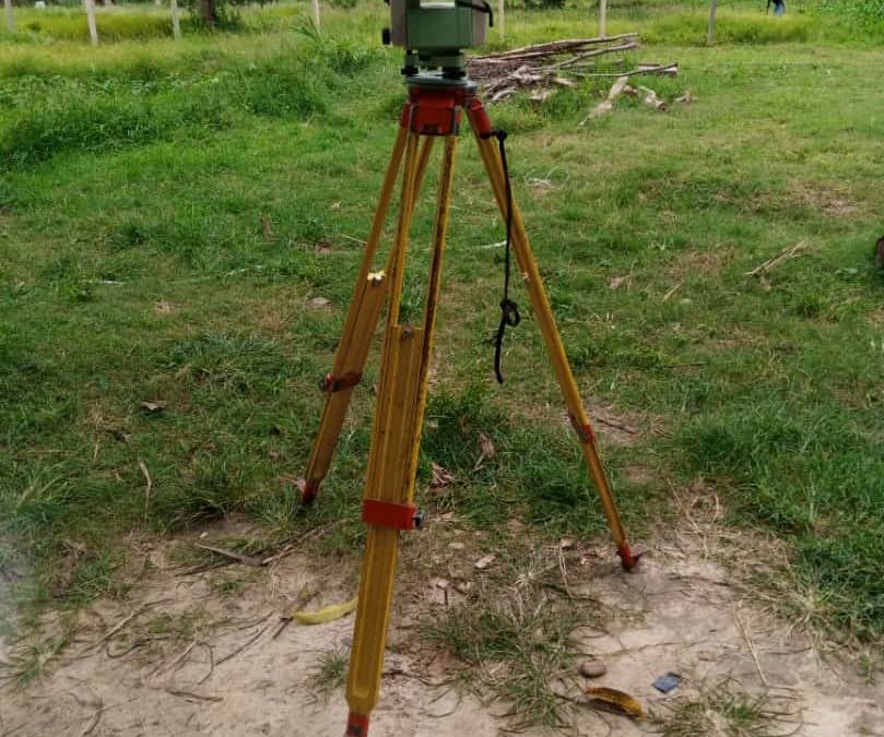
land surveyor in the field
You should have a survey done under any of the following circumstances:
- Prior to purchasing land, to be sure of what you are buying, and for insurance purposes.
- Prior to installing a fence, building a house, or performing other types of construction including commercial construction staking.
- Prior to dividing a piece of land into smaller parcels .
- When you sell a parcel of land not previously surveyed.
- To verify the amount of land assessed for taxes.
- When you think a neighbor may have encroached on your property to settle boundary line disputes.
- When the property owner wants to update an outdated property survey
- Getting title insurance.
Conducting a land survey has various benefits to you as the landowner. They include;
- Determining the accurate location of your land boundaries without speculation
- Identifying the location of property utilities
- Locate any features in the land that can limit the use of such a property
- For better environmental planning and helping know whether the land is a flood zone
- Helps land owner prepare the land for construction either for a fence, temporary or permanent structure.
- Helps in land valuation also and prevents your land from being undervalued or overvalued when doing valuation of the land
- Land survey helps in proper subdivision of land either for purposes of selling or inheritance


