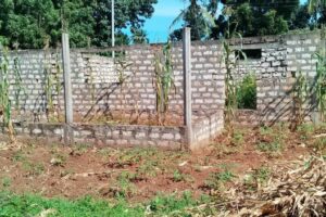
A boundary survey is an important component of property ownership and development. Typically, it is used to determine where property boundaries are located. This kind of survey is will define the corners of one’s property, sometimes described as a parcel of land, and will be accompanied by a drawing of the boundary lines from a boundary surveyor. Read more here.
Reasons behind boundary survey
- Buying property
- Dividing a parcel or parcels of land
- Adding improvements
- Before building on the property
Without a properly completed survey, it can lead to boundary disputes down the road. Therefore, it is imperative to recognize the importance of hiring a professional surveyor. GeoRole, offers survey services in Kenya including that of boundary and is ready to assist with your land surveying needs. Contact us today!
Our boundary survey process
Defining your property lines is the key objective for GeoRole Surveying. How do we do this?
- First, we review the county registry to locate any deeds for the property and surrounding properties.
- Second, we conduct research to locate documentation from previous land surveys, county offices, regional offices, ministry offices and historical societies.
- Third, and most important, we hit the ground for the survey. Each corner of the property is located and marked.
- Finally, we compile all of this information and complete the land survey and boundary survey drawing for the property.