Where should I find RTK correction services? worry no more. Here we are linking you to solution.
Muya CORS provides Real-Time Kinematic (RTK) corrections and Post-Processing (PP) services utilizing a network of Continuously Operating Global Navigation Satellite Systems(GNSS) Reference Stations (CORSs). Our CORS tracks all available GNSS satellites including GPS, GLONASS, BEIDOU and Galileo. It also provides static data RINEX files thereby increasing redundancy in static observations and precision of positioning. The solutions of our CORS are based on the most current ITRF realization(ITRF2014). The CORS are also fixed with respect to Kenya datum.
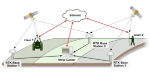
We are providing GNSS base stations and therefore no need for RTK GNSS base station. This saves users on GNSS base receiver costs and time usually taken in setting it up! Users only require a GNSS Rover and register with us. On registration, users automatically receive individual logging details to receive RTK corrections including IPs, Port, user name and password.
On registration users simply Connect, Correct, and Measure 24/7.
RTK corrections are available
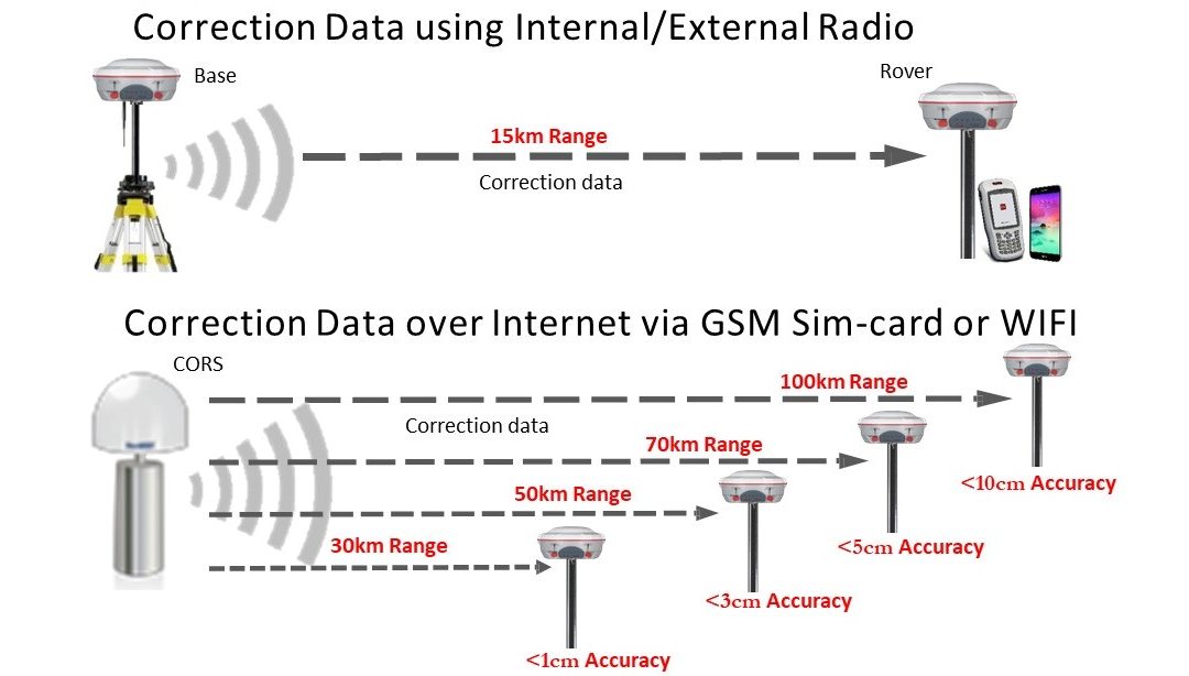
- Single CORS RTK corrections: from the nearest CORS to the User including Nearest RTCM 3.2, 3.1 and 2.3
- Networked CORS RTK corrections: averaged corrections from at least 3 nearest CORS including VRS 3.2, 3.1 and 2.3
Expected positioning accuracies
- 1cm accuracy within 30km from the CORS
- 5cm accuracy within 50km from the CORS
- 10cm accuracy within 100km from the CORS
- 50cm accuracy within 400km from the CORS
- 1cm accuracy within VRS covered areas
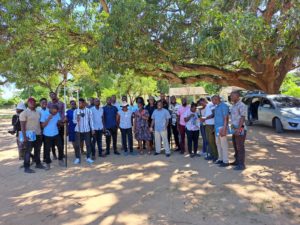
GNSS training
Muya CORS also offers GNSS Training packages designed for existing surveyors and engineers. A basic understanding of survey or setting out practices is required. If you are interested in taking part in a training course please contact us with your requirements and a member of the training team will be in contact to discuss your requirements.
When it comes to customer training and development, they’re working hard to bring something different to the table. In addition to technical support, they also understand that high quality training is critical and key to unlocking the full potential of your GNSS survey equipment. Their structured training programmes will enable you to take full advantage of your instrument’s capabilities, and improve your workflow both in the field and the office, with a view to increasing your productivity and streamlining your project workflows.
They offer a flexible selection of training packages to suit your company’s needs,experience and time frame, as well as the option to create your own based around the specific requirements of your project or organization.
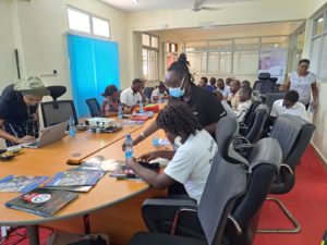
GNSS RTK configuration & practice
This course is designed to introduce individuals to the theory and practice of using RTK GNSS for centimeter-level positioning.
Upon completion of the course the participants will be able to:
- Understand overview of GNSS Technologies
- Identify the errors associated with GNSS and mitigation measures
- Continuously Observation Reference Stations(CORS)
- Understand the coordinates systems
- Concept of RTK
- Configuration practice on RTK Base/Rover, CORS/Rover using Microsurvey Fieldgenius and Android based GNSS field software
- Practice field works on RTK using Base/Rover, CORS/RTK using Microsurvey Fieldgenius and Android based GNSS field software
GNSS data processing
This course is suitable for those who have survey experience on carrying their static GNSS observations and require to gain practical skills on GNSS data processing.
Upon completion of the course the participants will be able to:
- Understand overview of GNSS Technologies
- Understand coordinate systems
- Identify various GNSS data processing software
- Identify various GNSS data and data formats and conversions
- Identify and use GNSS data from available CORS networks
- Understand the general flow/process of GNSS data processing
- Practice using selected software(Users may request)
GNSS CORS training
Theory: 1. Basic RTK concept, 2. Components of CORS, 3. Surveying with CORS, 4. Advantages of using CORS, 5. RTK Services in Kenya.
Practical: 1. Register with CORS service provider, 2. Subscribe RTK corrections, 3. Rover configuration, 4. Surveying with CORS
Land surveying | Valuation & Advisory | Property & Estate Agency | Physical & Land Use Planning | Environmental Management | Architecture & Landscaping
Contact: 0113209028
Email: georole20@gmail.com | info@georole.co.ke